The village of Carmunnock, just inside the county of Lanarkshire and less than a mile east of the Renfrewshire border, is located nearly 6 miles directly south of the centre of Glasgow and is nowadays in that city’s administrative district.
Geologists tell us that to the north the strata on the Campsie and Kilpatrick Hills shows basaltic rock from old lava, evidence that volcanic action once took place and boulder clay formed in the Ice Age that followed. On this southern stretch of land, undramatic and less distinctive outcrops from ancient disturbance such as the Cathkin Braes, Neilston Pad and Ballageich, little higher than the surrounding terrain, gently break the outline. In Carmunnock itself, the soil covering areas of rock is in places only inches deep.
Particularly north of the River Clyde, the land on which Glasgow is built consists of a number of drumlins or small hills as the result of ages of glacial activity. Some miles south of the river - the area we are interested in - where the wide sweep of land is based on glacier deposits with layers of sandstone, limestone, shalestone, carboniferous rock and boulder clay (the result of heat, pressure, ice and flood through the ages) alluvial action has meant that it is made up of a variety of sedimentary soils.
Although flat at first, the land on the south bank graduates to higher level after a distance and has similarly formed into a cluster of small hills. From the southbound Glasgow to Busby railway line in winter, you can see this area of low hills at the western end of the slightly higher and more rugged Cathkin Braes. Rising to a pleasant landscape of grassy slopes, these are the Netherton Braes with fields enclosed by hawthorn hedges, here and there woods and some fine houses. The village of Carmunnock sits on a southwest slope and in the hollow of another, roughly between the Netherton and Cathkin Braes.
Travelling by road directly south out of Glasgow, you neither see nor even imagine that Carmunnock exists until you are almost in it. Climbing gradually from the Kings Park area, the road has to circuit the south-west slope at the end of the Cathkin Braes - part of the gentler Nethertons - before the first houses of the village are sighted further up. Even approaching from the east down the high road that comes along the top of the Cathkin Braes, Carmunnock is hidden from view until you are almost among its buildings.
Once there - after busy traffic from all directions has gone on its way - you are in a comparatively quiet, self-contained village going about its daily business just as it has done from times long ago. Surrounded by green fields in the fresh prevailing south-west air, Carmunnock is a village with a surprising independence in these present days.
Although Carmunnock at nearly 500 feet above sea level is hidden completely from the great city lying in the Clyde valley on the north or “front side” of the Cathkin Braes, there is an expansive view from it, overlooking the vast spread of south-west suburbs and far beyond.
Away on your left, like a long low table is the flat-topped outline of Ballageich on Eaglesham moors. To the right of it - past the Arran mountains in the far back ground - tree-covered Neilston Pad, and more Renfrewshire hills. Move further right to the Cowal area, then to some of the Arrochar Alps peeping over the Kilpatrick Hills, until you see the unmistakable Ben Lomond standing boldly above the slopes in its foreground.
Still veering round to the north, grand heights of the Crianlarich area in Perthshire rise far behind Dumgoyne and the low Campsie Fells that are just beyond Glasgow. In good visibility it is a view to enjoy in all seasons; but when snow tops those distant mountains in a clear wintry sky, it is a most exhilarating sight.
No one knows from how early the community of Carmunnock existed. But clear signs of Bronze and Iron Age settlers have been found in the district. A cup-and-ring marked stone probably dating from the Bronze Age or earlier, was found covered over with turf in the vicinity of Carmunnock village; and a cist from the same period - a sandstone grave - containing a cinerary urn was found on the Cathkin Braes in 1787.
Several historians mention archaeological finds. Two of these are the Rev. Adam Forman, minister of Carmunnock from 1792-1811 in his 1796 Statistical Account of the parish (included in Volume VII for Lanarkshire), and by David Ure, assistant minister at East Kilbride in his History of Rutherglen and East Kilbride 1793.
The second (1841) Statistical Account by Carmunnock’s Rev. John Henderson and the Rev. William Ross’s book Busby and its Neighbourhood mention the remains of a boat made of black oaken planks originally secured with strong wooden nails or pins but bearing no sign of iron and thought therefore to be very early. It was found in 1831 when deepening a ditch on the march between Cathkin and Castlemilk.
The Records Department of Glasgow’s Kelvingrove Museum tells of an Iron Age oak dug-out boat (hewn out from a tree trunk) also at this location, measuring 3 metres by .6 metre. Were these boats washed up from the River Clyde in a flood and buried there in the mud? Did the course of the river change at some period? Or was there once a loch at the spot where they were found? Similar boats of this period are to be seen in the Hunterian Museum at Glasgow University but, sadly, the Cathkin ones are not among them. They may have been destroyed long ago, the museum custodians say.
An ancient underground village of 42 dwellings thought to have been of a period earlier than Iron Age was unearthed about 190 years ago at Overlee on the west bank of the White Cart, opposite Netherton Braes. It is written about in the 1790s by the two earlier churchmen and in his Statistical Account of the parish by the Rev Charles Harrison, minister of Carmunnock from 1948-61.
A camp thought to have been Brito-Pictish once existed on what is now the 13th green on Cathkin Braes Golf Course. A road that long ago terminated in Castleton’s (Castlemilk) Estate is thought by today’s historians, however, not necessarily to have been as old as of Roman times. Rough Hill near Philipshill south of Carmunnock is reported as a Stone Age burial chamber or mound which was later a motte and Manor - the latter probably built of wood on top of it - belonging to Philip de Valois, lord of the Manor. Another Stone Age mound is Castlehill near Kittochside village, whereas the mound beside Meikle Dripps farm was a Moot Hill where the local lord spoke with his feudal tenants in Norman times.
The Rev Adam Forman and David Ure wrote in some detail too - and there are illustrations in Ure’s book - about finds discovered in a field near Castlemilk in the summer of 1792. An iron helmet, an iron neckpiece, a camp kettle, a copper camp oven, a steel dagger and fragments of a lead vase were discovered. They are thought by today’s historians to belong to the post-medieval period.
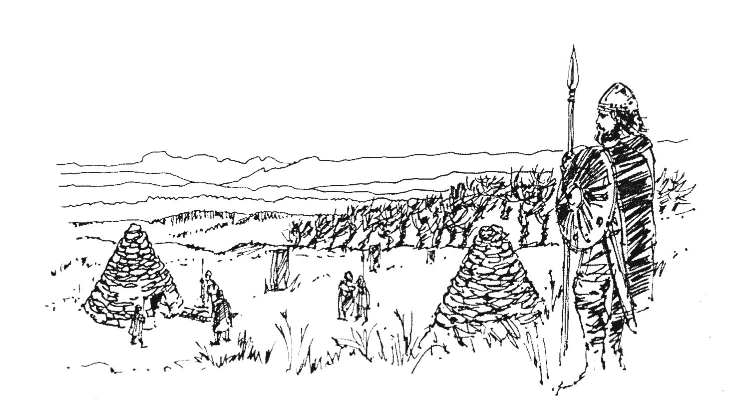
There were at least four cairns from Celtic times on or near the Cathkin Braes till early in the 19th century. One contained urns with fragments of blanched human bones and there were ornaments or pieces of these. Although cairns in elevated positions were sometimes used as signal points where fires were lit, the ones on the Cathkin Braes were burial cairns for sacrificial ceremonies in accordance with Celtic Druid religion. Burial cairns also existed along the banks of the Kittoch Water.
Cremation of the dead was the custom and in the case of persons of superior rank or authority, their ashes were put in urns sometimes with the addition of precious possessions or ornaments once worn by the deceased. The urns were then enclosed in a cavity lined with stones in the centre of the cairn, like a coffin, and covered over with a large slab of fine freestone used, it is thought, as a kind of altar. Fine freestone was probably that much rarer smooth sandstone, but which in this instance may not have belonged in our district.
Mr. Forman and Mr. Ure wrote most informatively about these tumuli: that the cairns were large, stood on elevated situations at distinctive points of observation and were conical in shape. Their reports say that urns found in some state of disintegration in or near one of the cairns had been made of coarse clay and the few ornaments painted over with a green enamel that were found with some of the incinerated remains were in styles and materials traced to the time of the Romans.
Although I have made enquiries at Rutherglen Museum, Hamilton, the Kelvingrove and Hunterian in Glasgow and at the National Museum of Antiquities in Edinburgh, there appears to be no knowledge nowadays as to the whereabouts - if they still exist in recognisable form - of the finds dug up at Castlemilk in 1792. Nor is there any trace of urns or ornaments found about the same time in or near the cairns. Museum historians suggest that some of the items may still be in the possession of prominent families in this area, however.
Even in 1793 and 1796 when Ure and Forman were writing, there were fears for the preservation of these cairns. With development of the land beginning to take place at that time, stones from them were already being removed for the building of dykes, cottages and steadings. In the case of one of the cairns, it is thought in the present day that its foundations were undermined long ago when a ditch for land drainage was dug near it. They had stood from before Christianity and the beginnings of our history.
The district, settled by nomadic Celts seeking good lands, was obviously strongly influenced by Druidism. It is thought that this led St. Cadoc, said to come from Wales, friend of Gildas and Marc Canonmanus, King of Strathclyde, to preach in south-west Scotland in 528 AD and create Christian communities in this area. Cambuslang was established by St. Cadoc, thus influencing smaller communities in the district, notably here - the original parish of Carmunnock.
The Celtic words “caer mynock” (the monks’ fort) and “caer bannauc” (the hill fort) are suggested as being the origin of our village’s name. Carmunnock, or as it was spelt long ago Carmannock or Cormanoc, the community established here from those early times, had a succession of monks as its Christian teachers throughout the centuries, a hillside settlement that must often have had to defend itself against marauders.
In 1165 a Manor stood in the vicinity of the village, perhaps a little further up the braes, and the lord of the Manor was Anselm succeeded at his death by his son Henry, Henricus de Cormanoc. At Henry’s death in 1189, his lands at Cormanoc which comprised the original parish, were granted at his bequest to the Priory at Paisley, the religious stronghold founded in 1163 by Walter FitzAlan, High Steward of Scotland, and which in 1245 became Paisley Abbey.
From there, the Abbot sent his monks to minister in the tiny community of Cormanoc. Under his rule, Christianity was taught, regard taken for the welfare of inhabitants, encouragement and teaching given on the tilling of the soil, the growing of food, in the use of animals on the land, corn mills were built on the river banks, and tithes (taxes or rents) were taken for the support of the parish and the dominating Abbey. These monks who were called vicars appointed by Paisley Abbey to be the preachers at Carmunnock continued thus until the time of the Reformation of the Churches in 1560.
Thereafter for 37 years, our parish came under the Collegiate Church at Hamilton held in the Patronage of the powerful Hamilton family, this district’s Lairds. The Rev Dr Henry Hutchison MA, BEd, BD, M. Litt, PhD, minister here from 1977-93, wrote two books Kirk Life in Old Carmunnock and Carmunnock Church 1854-1947, and they are full of information and interest covering the known history of this long period, from the earliest times of our village church and its parish.